
Our Services
Lot Survey/Boundary Survey
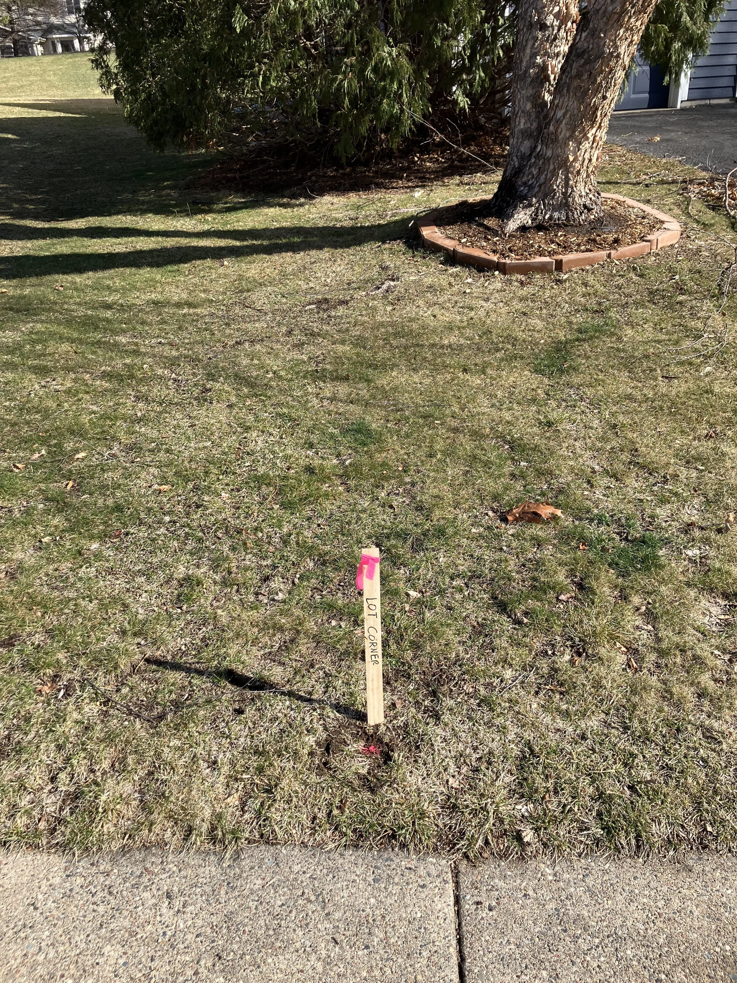
We will locate and verify the property corners. We will re-establish corner monuments if they are missing. Corners will be marked with wood lathe and pink flags.
No drawing is prepared for this survery.

Certificate of Survey
This is typically required by cities if you are doing significant improvements on a lot. We will prepare a plan showing the boundary, structures, hardcover calculations, and more depending on your needs.

ALTA/ACSM Land Title Survey
Title insurance companies often require this survey when commerical or industrial lots are sold or financed. We are provided the title commitmment which shows the legal description, easements, and other aspects of the property. We show this information along with existing conditions of the property per the latest ALTA/NSPS minimum standard of detail requirements.

Lot Splitting/Lot Line Adjustment
We can guide you through splitting a lot or modifying the boundary. We can prepare new a new legal description and work with municipal officials.
In some situations lots cannot be split or adjusted so the new lots would need to be platted. See right.

Preliminary & Final Plats
If you are subdividing a parcel a plat is usually required. The prelinary plat shows the existing conditions and the proposed new boundaries. The final plat shows the new boundary and is recorded with the county.

Topographic Survey
We can document the topography of a site to show elevations and contours of a property. This can be be used to understand drainage on a site or for planning grading projects on a site.

Civil Site Plans
Our team consists of licensed surveyors and civil engineers. We can prepare plans for any site project you may face. We offer experience and expertise to assist with planning review, permitting, and construction.

Construction Staking
Our field crews can accurately and efficiently layout projects. We make sure that builings, parking lots, or anything else you build is in the correct locations.

Easement Preperation
We can write a description and draw a map for an easement. This can be used to file the easement at the county
Contact Us
Interested in working together? Fill out this form and we will be in touch shortly. We can’t wait to hear from you!